Mosquito Range
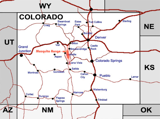
Mosquito Range extends for approximately 40 miles from Frisco and Interstate Highway 70 in the north to the east of Buena Vista in the south, in the Summit, Lake, Park and Chaffee counties. Some people exclude the Tenmile Range from it, citing geological differences (although it is hard to say when looking at the geological map), but the actual mountain chain is perfectly continuous. There is a vague description of the south end of the mountains ranging from Weston Pass to Fremont county border (south west border of South Park). Therefore, the Range length is from 25 to 65 miles, depending on the definition. The 40 miles, mentioned above, is from Frisco to East Buffalo Peak. Actually, this mountain range continues south (being nameless) and meets the northern edge of the Sangre de Cristo Mountains, east of Salida, and blends eastward with the southern end of Front Range Mountains. The disputed parts of Mosquito Range are marked in light red on the map below and shown in detail on the panoramic "View of Mosquito Range..." photo below. The highest point in Mosquito Range is Mount Lincoln, 14,286 feet. The photographs are arranged from the south to north and cover continuous area from the Buffalo Peaks to Royal Mountain, near Frisco, viewed generally from the east side. Click on the thumbnails to enlarge.
|
 |
 |
 |
 |
Location of Mosquito Range in Colorado |
View of Mosquito Range from Mount Princeton |
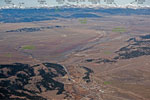
East and West Buffalo Peaks |
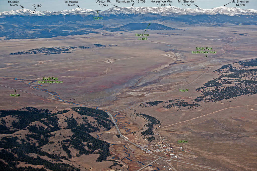
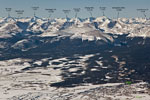
The South Park view from Harstel, with Weston Peak and Mount Sherman |
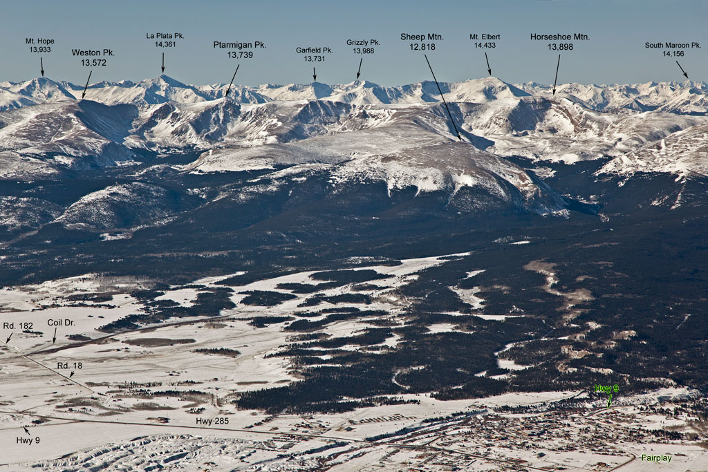
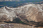
From Weston Peak to Horseshoe Mountain |
 |
|
|
|
|
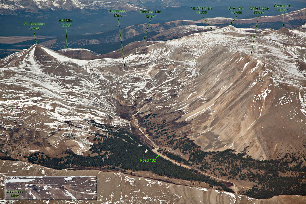
| Mount Sheridan and Mount Sherman |
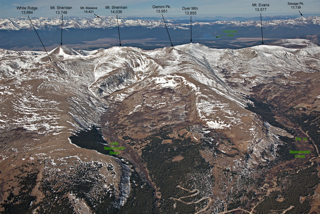
From Mount Sheridan to Moun Evans |
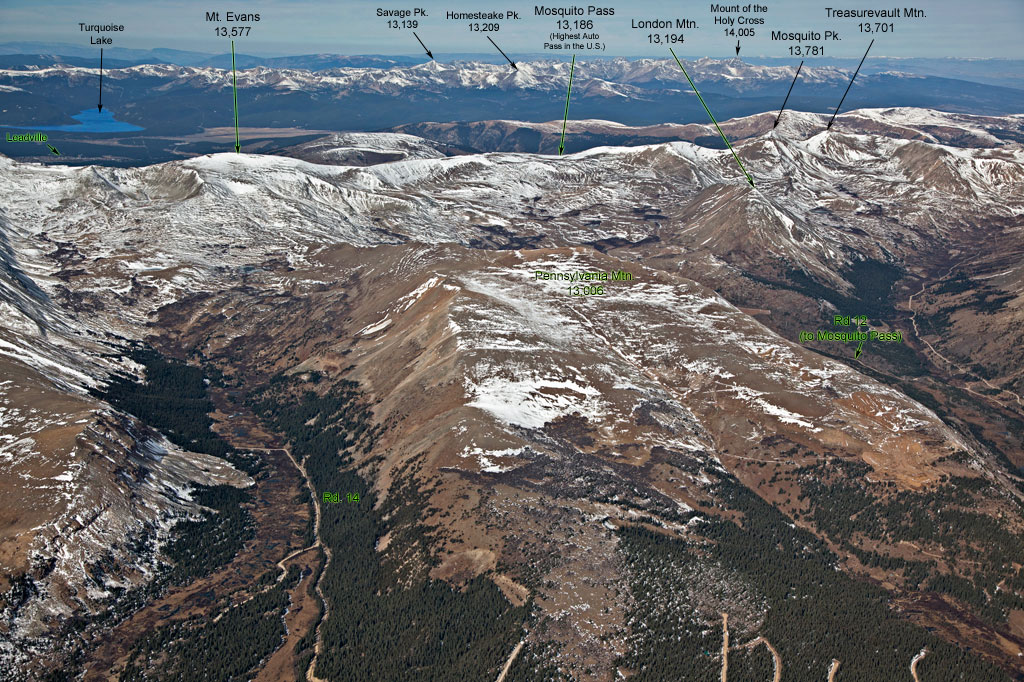
From Mount Evans to Treasurevault Mountain |
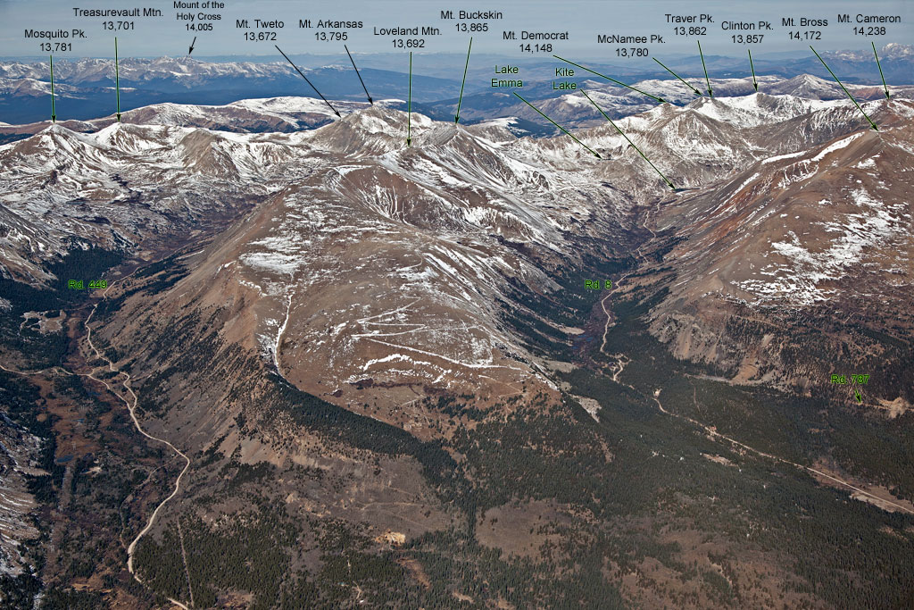
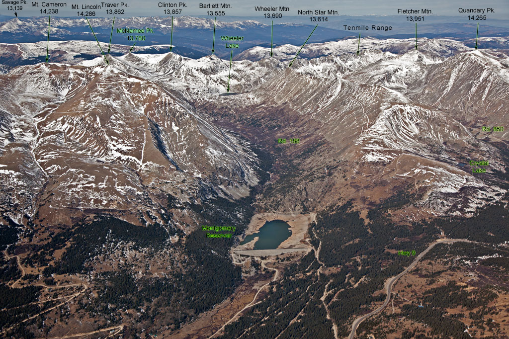
From Mosquito Peak to Mount Cameron |
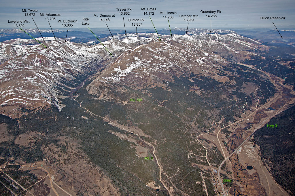
From Mount Tweto to the north |
 |
|
|
|
|
| From Mount Camoron to Quandary Peak |
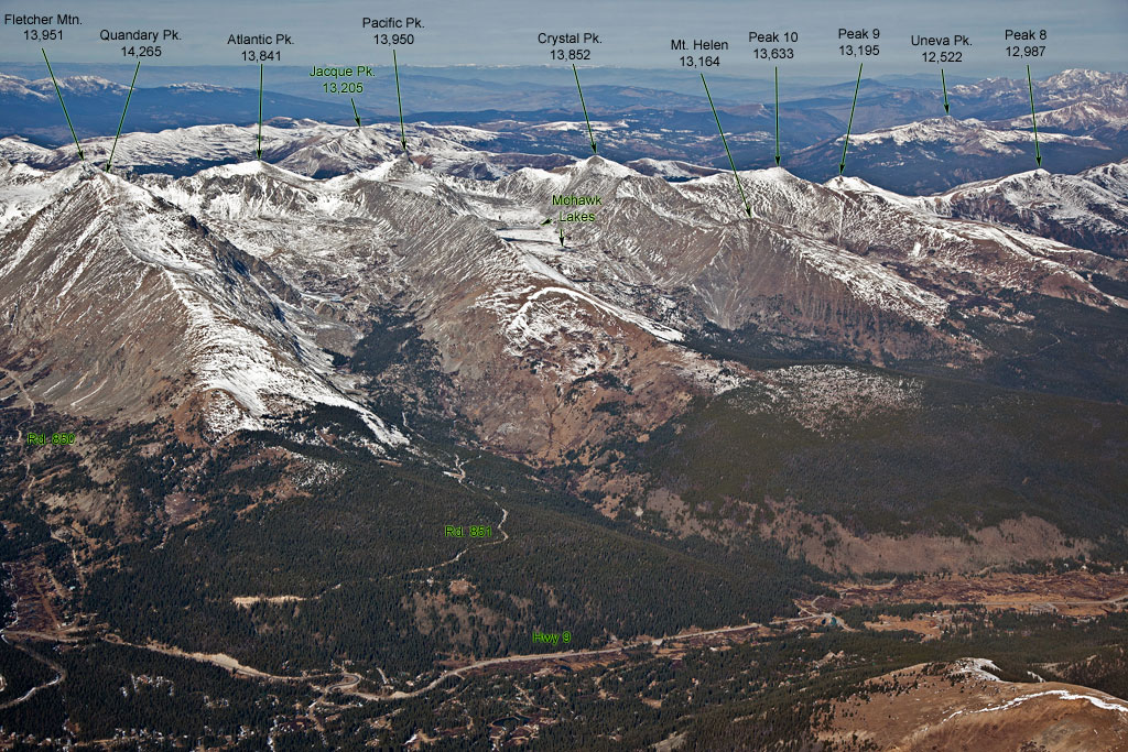
From Quandary Peak to Peak 8 |
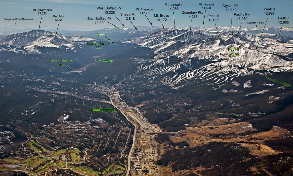
Breckendridge area |
South view from Breckendridge |
North section of Tenmile Range and south of Gore Range |
For complete set of Mosquito Range pictures (views from east and west), please see description of the book "Eagle’s View of the Mosquito and Gore Ranges".


© 2012 PikesPeakPhoto. All
rights reserved.