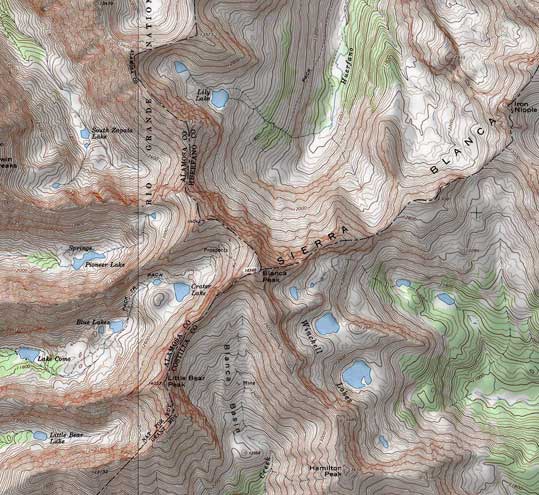
Blanca Peak (14,346') is a very old pyramid, ten thousand times older than human-made pyramids in Egypt, formed around 40 million years ago in Eocene. The map above shows clearly its four sides. The 'walls' were eroded by glaciers forming basins. Three of them contain beautiful lakes. Only the south wall - Blanca Basin is lakeless as it's uniformly steep.
There are spectacular ridges coming down from the summit: south-west features Little Bear Peak (14,037), south-east ends up with Hamilton Peak (13,658), north-east goes trough Iron Nipple (13,500) connecting sideways to Mt. Lindsey (14,042) but continuing straight to Ute Peak (13,828), and north west, consisting of Elingwood Peak (14,043) and continuing through California Peak (13,849). The north-west ridge is the largest one - it's in axis of the Sagre de Cristo Mountains, so it eroded into its own separate valleys, several containing glacier lakes. Aerial photos show most of them.
Click on the links below or on the map to the left to view various parts of Blanca Massif.

